Early McMaster’s Lane intent: To facilitate Hannibal/Palmyra traffic
- Jul 6, 2018
- 6 min read

This photo, taken circa 1969, shows the newly revamped U.S. 61 north of Hannibal. If you zoom in on this photo, you will notice that many changes have been made to the landscape in the past 49 years. The intersection of Palmyra Road and what was once known as McMaster Lane is at left. McMaster Lane was originally planned as a connector road between West Ely Road and Palmyra Road. FILES OF MARY LOU MONTGOMERY
MARY LOU MONTGOMERY
A short notice in the Quincy Daily Journal on Nov. 2, 1915, paints an interesting portrait of the landscape of what is now one of the most heavily traveled roads in town: McMaster’s Avenue.
On a Sunday afternoon in 1915 – the first Sunday in November – two cars collided at the intersection of the Hannibal-Palmyra Road and McMaster Avenue.
The newspaper noted that this was a dangerous corner, with a turn at the top of a hill. It was at that hilltop that the two cars collided. One was driven by J.L. Onstott, manager of the Hannibal Lumber Company, and the other by Will Morton of Taylor, whose mother lived in Hannibal. The occupants were all thrown from their vehicles, but uninjured. Both vehicles were “smashed”.
When picturing the many schools and businesses now near that intersection, it may seem strange to realize that the land was then farm and woodland. No Tom Boland Ford. No Burger King. No Hannibal-LaGrange University. No Hannibal Middle School. There was no U.S. 61 – just a local road built to facilitate farm trade between Hannibal and Palmyra. Vehicles were most likely Model T’s, traveling on dirt roads, which were still shared by horses and wagons
The Hannibal-Palmyra Road dates back to the stagecoach era. McMaster’s Avenue is much newer: Dating to the 1880s.
Early route
In May 1888, the Hannibal Courier published a suggested route that would take traffic from Hannibal to Palmyra, following water sources, which would ensure a practical grade for horse-drawn vehicles.
The proposed route began at the Cruikshank lumberyard along Bear Creek in the Market Street area, which was then known as the West End. The route would follow Minnow Branch to its head waters in the area known as Elmwood Park. This neighborhood was located at the intersection of what is now U.S. 61 and Route MM.
In 1889, taxes were assessed against property owners along the route’s path. James McMaster asked for a reduction on his 80 affected acres, and the County Court agreed reduce his assessment.
Dr. Z.P. Glass lived in the area of the current Steamboat Bend Shopping Center, in an area known as Frytown. The proposed road would lead from Elmwood, along the foot of the bluff, following the creek north past Dr. Glass’s residence, and on north through the James McMaster property to the intersection with the Hannibal-Palmyra Road.
A big project
In 1893, there was once again talk about the route, but this time, it was in the format of an electric railway.
M. Doyle, president of the Hannibal Street Railway Company, told the Courier-Post:
“Although electricity is yet in a great measure undeveloped and in its infancy, yet it is rapidly becoming better understood and just in that ratio is taking the place of steam and other propelling agencies. It is only a question of time when steam will be supplanted by electricity and steam engines and locomotives will be relegated to the backwoods.”
He suggested the same low-grade route through the area west of Hannibal for this electric railway. “The most practicable route would probably be out the Frytown road to Dr. Glass’ residence, and thence due north by way of the McMaster place to the Palmyra road, to the city of Palmyra.”
That is the route of today’s McMaster’s Avenue.
Indian Mound Park
In 1894, plans for a new boulevard from the city limits of Hannibal, on St. Mary’s Avenue, to the 84-acre Indian Mound Park were announced. The following year, the Street Railway Company completed a street car line to the park, located in the area west of McMaster’s Avenue beginning where U.S. 36 now intersects with U.S. 61, and going north.
The street car line was completed in June 1895, putting the park within reach of Hannibal’s residents. There was a baseball field at the park, and plenty of room for families to gather for picnics. In 1895 a race track and a natatorium (a building containing a pool) were planned by James Shaw, who had leased the land.
All went well with the road to Indian Mound Park until a cloudburst at midnight July 7, 1897, washed out the streetcar tracks leading to the park, and left many people without a means of getting back to town.
The Palmyra Spectator reported on July 8, 1897: “They were finally brought in by hacks and excursion wagons, some of them being compelled to remain at the park until 3 a.m.”
In 1909, Capt. W.F. Chamberlain and Silas Osterhout, both property owners on St. Mary’s Avenue, purchased the tract of land known as Indian Mound park for $30,000. They bought it as an investment with the prospect of future residential lot development.
1903
A special county road tax had been collected from property owners, and in 1903 there was discussion regarding how best to use Hannibal’s share of the tax dollars.
George W. Pine was presiding judge of the Marion County Court. He lead the discussion, and it was agreed that the money would be divided:
$1,500 on St. Mary’s Avenue between the city limits and the intersection of West Ely gravel road.
$200 on the McMaster lane in the vicinity of Indian Mound park.
$1,000 on the road leading from Palmyra road near the Wray Brown place in Clear creek, providing those living along the thoroughfare would subscribe an additional $300.
1923
The first section of the roadway from Hannibal to Palmyra to be paved with concrete began at the end of St. Mary’s Avenue and continued 1.3 miles north along McMaster’s Lane. The right-of-way was widened and the highway itself was 18 feet wide. The bid was awarded to a Hannibal firm and work was expected to begin in early April 1923. The projected cost for the 1.3-mile segment was $28,000.
The Oct. 18, 1923 edition of the Palmyra Spectator described the new road:
“The grades are easy and the turns slight and it is a pleasure to ride on. This is the first piece of roadway completed in this section under the new state road program.”
The following year, more concrete was poured. The Sept. 19, 1924 Palmyra Spectator explained:
“The work of laying the concrete slabs on the Hannibal-Palmyra road will begin in the next few days. This work consists of about a mile extending from the end of the McMaster lane toward Palmyra. R.I. Whitacker has the contract for this work and it is estimated that it will take about eighteen working days to complete this project. It then takes several weeks longer for the road to cure before it will be ready for travel. About the same time another contractor will be working on a mile and six tenths of concrete road on No. 8 highway, which leads from Hannibal to Monroe City.”
1933
Work began to widen what was by now U.S. Highway 61 (McMaster’s Avenue) to 10 ½ feet, in order to help traffic flow near the new high school, which was under construction. In addition, new offices for the highway department were constructed on McMaster’s Avenue, just to the north of the new high school. The completed high school building was accepted from the architects on Jan. 19, 1934.
1946
A.A. Ahlers announced plans for a new 30-room hotel to be located on McMaster’s Ave., at the intersection with West Ely Road.
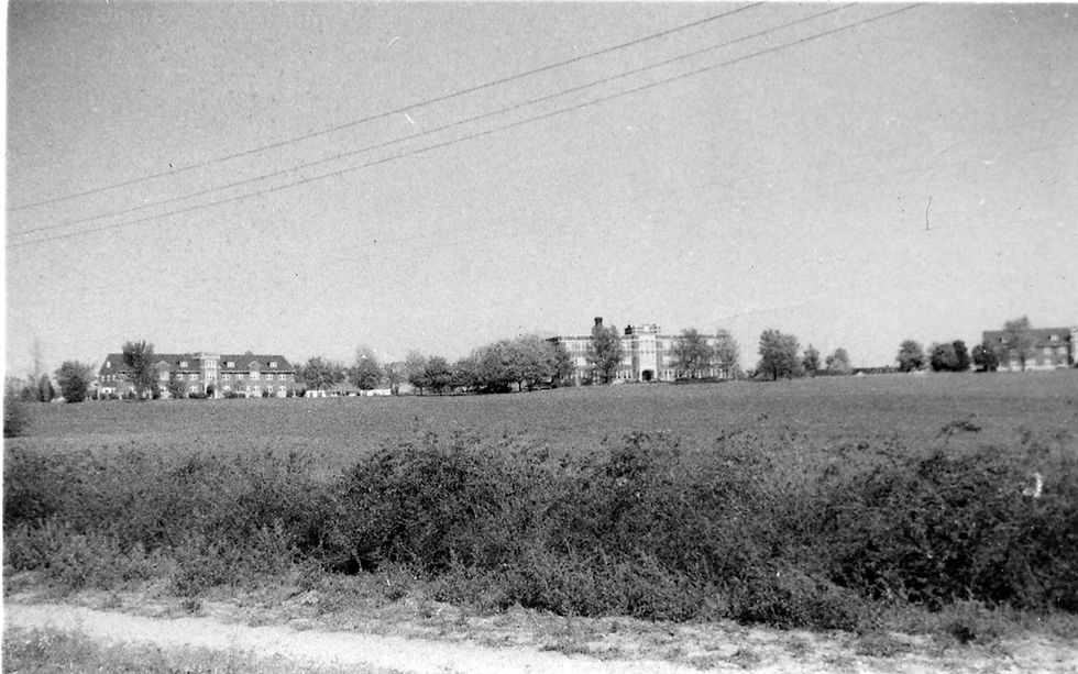
This photo shows the new Hannibal-LaGrange College, circa 1928. STEVE CHOU COLLECTION
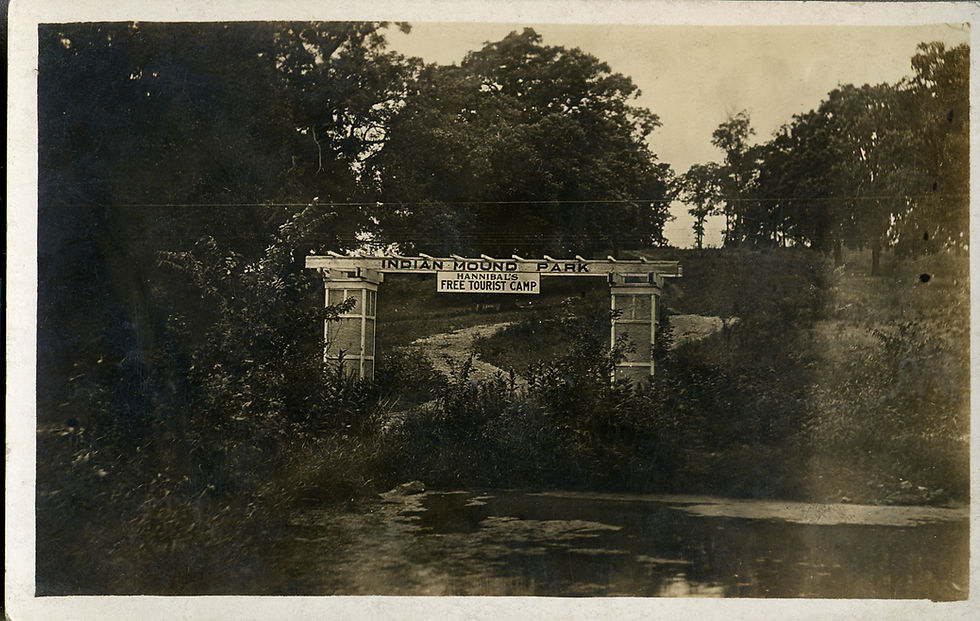
This sign designates the entrance to Indian Mound Park. STEVE CHOU COLLECTION

In 1901, the city limits’ western boundary was what is now known as Country Club Drive. This plat map shows three roads leading west from Hannibal: The Palmyra to Hannibal gravel road, to the north; the West Ely Gravel road, center, and the road branching out from St. Mary’s Avenue, to the south. U.S. 61 going north and south between the three east-west roads wouldn’t be designated until the 1920s. McMaster’s Avenue began as McMaster’s Lane, with an electric street car route established from St. Mary’s Avenue in order to take Hannibal residents to Indian Mound Park. The road was eventually extended north to connect with the Palmyra to Hannibal Road. 1901 Plat Map, Marion County Missouri.


Comments